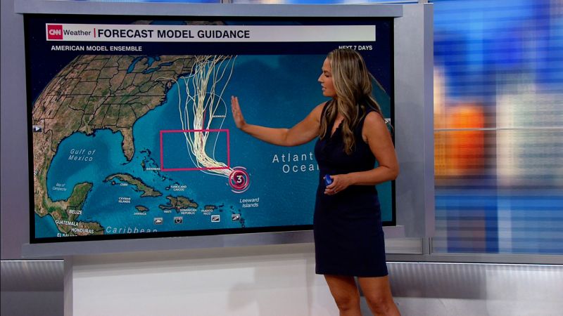
Hurricane Lee, now a Category 3 storm, is starting to send hazardous beach conditions to Southeast US, forecasters say
Hurricane Lee was starting to send dangerous surf and rip currents to parts of the southeast US coast late Sunday – and more of the East Coast is expected to see hazardous beach conditions in the coming days as the storm moves up the Atlantic, forecasters say.
Lee, a Category 3 storm with maximum sustained winds of 120 mph, was centered Sunday night in the Atlantic, about 310 miles north of the Caribbean’s northern Leeward Islands and headed northwest, the National Hurricane Center said in an 11 p.m. ET advisory.
The powerful storm, which has fluctuated in intensity throughout its time over the Atlantic, could become a Category 4 by Monday morning before fluctuating again later in the week, forecasters said.
It remains too early to determine Lee’s long-term track for later this week and how significant the impacts could be for northeastern US states, Bermuda and Atlantic Canada.
But the storm already was generating swells that were affecting many of the far eastern Caribbean islands as well as the British and US Virgin Islands, Puerto Rico, Hispanola, the Turks and Caicos, the Bahamas and Bermuda. Those swells could cause life-threatening surf and rip currents, the hurricane center said Sunday.
And “dangerous surf and rip currents have begun to reach portions of the southeast US East Coast and are forecast to worsen and spread northward along much of the US East Coast during the next couple of days,” the hurricane center said in the 11 p.m. ET Sunday advisory.
The storm grew larger – though not stronger – Sunday evening. Hurricane-force winds extended up to 75 miles from center by 11 p.m. ET, the hurricane center said – up from 45 miles six hours earlier.
By midweek, Lee is expected to make a turn to the north, likely moving between Bermuda and the US East Coast late this week.
Lee, which was a Category 1 storm Thursday, intensified with exceptional speed into Category 5 status as it moved west across the Atlantic, more than doubling its wind speeds to 165 mph in just a day.
Vertical wind shear and an eyewall replacement cycle – a process that occurs with the majority of long-lived major hurricanes – then led to the weakening of the storm, the hurricane center said.
