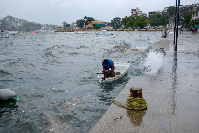
Hurricane Hilary strengthens to a Category 4 storm, but is expected to weaken before bringing rain to the Southwest US this weekend
Hurricane Hilary has intensified into a Category 4 storm as it nears Mexico’s Baja California peninsula, yet is expected to weaken over the weekend as it brings rain and the threat of flooding to parts of the Southwest US.
Hilary was churning about 425 miles south of Cabo San Lucas, Mexico, early Friday morning with sustained winds of 140 mph with stronger gusts, the National Hurricane Center said.
The storm strengthened to a Category 3 hurricane Thursday evening and could further intensify Friday morning. Hilary is forecast to remain at Category 4 strength going into Saturday and then begin to weaken throughout the day as it enters much colder waters to the west of the peninsula.
Hilary’s center is on track to approach the peninsula on Friday and over the weekend, prompting Mexican officials to issue a hurricane watch and tropical storm watches and warnings for parts of Baja California Sur, the hurricane center said.
There remains a wide range of outcomes for the heaviest rain and strongest winds in the US as the storm moves north over the next couple of days. Small deviations in the hurricane’s track could change the forecast for the most intense rain and wind.
“The threat of significant wind impacts continues to increase for northern portions of the Baja California Peninsula and the Southwestern United States, especially in areas of mountainous terrain,” the hurricane center said Thursday night.
Flash flooding and mudslides may also be triggered by downpours in parts of the peninsula from late Friday into Sunday.
Hilary is expected to produce rainfall amounts of 3 to 6 inches, with isolated maximum amounts up to 10 inches, across portions of the Baja California peninsula through Sunday night. In addition, a storm surge could produce coastal flooding along the western part of the peninsula and will be accompanied by large and destructive waves.
Southwest braces for possible flooding
Hilary is expected to substantially weaken before reaching Southern California and parts of the Southwest but there’s an increasing chance the regions will be significantly impacted by heavy rain and flooding.
Heavy rainfall is expected to begin impacting the Southwest on Friday and through early next week, with the most intense downpours likely on Sunday and Monday, according to forecasters.
Southern swaths of California and Nevada could see 3 to 5 inches of rain with isolated amounts of up to 10 inches. Smaller amounts of 1 to 3 inches are expected across central parts of those states as well as across western Arizona and southwest Utah.
Prolonged rain may oversaturate the ground and overwhelm waterways, potentially worsening the flood threat.
Weekend flood watches have been issued across southern California stretching from San Diego to Los Angeles as residents brace for potential deluges.
The National Weather Service in Los Angeles has also warned of the potential for dangerously high surf, rip currents and coastal flooding.
If Hilary makes landfall in California as a tropical storm, it will be a rare occurrence – the first such storm there in nearly 84 years and would be only the third tropical storm or stronger to do so on record, according to data from the National Oceanic and Atmospheric Administration.
Parched Southwest may see brief relief
As the rainfall passes through the Southwest, it may help combat prolonged drought and recharge depleted groundwater.
Drought conditions persisted in California and Arizona this week and expanded in New Mexico, the US Drought Monitor reported Thursday.
Thanks to Hilary, “multiple years’ worth of precipitation could potentially fall in some of the driest parts of California,” Daniel Swain, a climate scientist at the University of California at Los Angeles, said Wednesday.
Among those spots is Death Valley, California, the hottest place on Earth. Death Valley typically receives about 2 inches of rain across an entire year, according to NWS data. Moisture from Hilary could unleash enough rain to give Death Valley at least a year’s worth of rainfall in a single day.
But the deluge could also prove dangerous. Around 1,000 people became stranded in Death Valley National Park last August when 1.46 inches of rain fell in 24 hours, triggering flash flooding that wiped out roads and entombed cars in floodwater-swept debris.
The region has also suffered from the absence of a seasonal monsoon that supplies a large percentage of its yearly rainfall, leaving cities like Phoenix desperate for more rainfall as they endure weeks of sweltering temperatures.
Now, the region is expected to get some relief from the extreme heat as the combined rainfall and increased cloud cover could lower triple-digit temperatures by as much as 20 degrees. The cooling may even help Phoenix break its dangerous heat streak by bringing temperatures below 100 degrees for the first time since mid-June.
