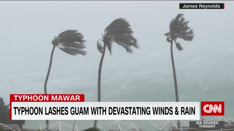
Super Typhoon Mawar strengthens to the equivalent of a Category 5 Atlantic hurricane as it moves away from Guam
Residents of Guam are dealing with damage and widespread power outages after the small US territory was walloped by hurricane-force winds and overwhelming downpours from powerful Typhoon Mawar.
Mawar’s eye passed just north of Guam Wednesday night local time, but the island was still battered by the most powerful winds and torrential rains from the storm’s eyewall, prompting its governor to urge residents to shelter in their homes until conditions were declared safe.
The storm – the strongest to impact the island in decades – was sweeping the island early Thursday with maximum sustained winds of 140 mph and gusts of up to 165 mph, the equivalent of a Category 4 Atlantic hurricane, the Joint Typhoon Warning Center said.
As the storm continues to move away from Guam, it has strengthened to the equivalent of a Category 5 Atlantic hurricane, with winds of 165 mph and gusts up to 200 mph. It’s not expected to threaten land for the next several days, the warning center said.
Mawar is the fifth storm of the year to reach this intensity, according to hurricane researcher Jeff Masters. Only five Category 5 strength storms develop each year on average, meaning 2023 has already had a year’s worth of these powerful storms – with nearly all of the Atlantic and Pacific hurricane/typhoon seasons still to come.
Later Thursday, Gov. Lou Leon Guerrero said the winds had significantly slowed and roads appeared passable but said residents should remain at home.
“We have weathered this storm. The worst has gone by, but we are going to continue experiencing tropical storm winds up to about 40 to 50 miles per hour, so I ask you again to please stay home for your protection and your safety,” Guerrero said in a video address.
The island was inundated with rain, with some areas receiving more than 20 inches over 24 hours. The northern village of Dededo saw 24.5 inches while the central west coast village of Piti had more than 22 inches.
No storm-related deaths had been reported as of 10 a.m. Thursday, according to the governor’s press secretary, Krystal Paco-San Agustin.
Though conditions are beginning to improve, the threat isn’t over. Heavy rainfall, whipping winds and strong storm surge are still possible.
Before the storm’s arrival, officials warned it could bring life-threatening storm surge and dangerous coastal flooding. Residents in low-lying coastal areas were ordered by Guerrero to evacuate as it approached.
After President Joe Biden approved an emergency declaration for Guam ahead of the typhoon, FEMA said it has more than 130 staff deployed or prepared to respond if disaster relief is needed.
Mawar will continue to move west-northwest, away from Guam, toward the northern Philippines and Taiwan. The storm is forecast to strengthen over the next 12 to 24 hours, before slowly weakening.
Guam is home to about 150,000 people and several US military installations. Super Typhoon Pongsona hit the island in 2002 with sustained winds of 144 miles per hour and gusts to 173 mph, according to the weather service.
Island almost entirely without power
Most of the island was without power by Wednesday afternoon, with only 1,000 of the Guam Power Authority’s approximately 52,000 customers receiving energy, the utility said.
Hazardous wind conditions made it unsafe for the utility’s crews to continue making repairs, it said.
“We are working hard to maintain the last remaining customers through the storm,” the power authority said. “Our GPA team is prepared to immediately begin restoration as soon as winds decrease to safe levels,” it said.
Guam Memorial Hospital began using a standby generator in order to continue operations, it added.
