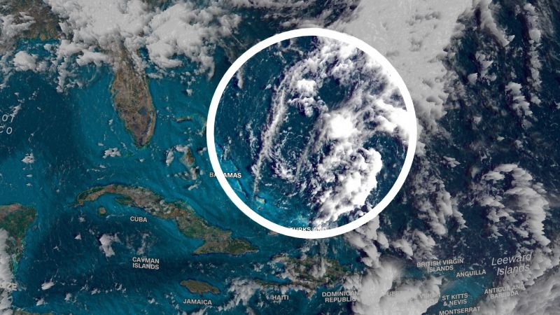
Hurricane season starts next week. Forecasters are already watching a system in the Atlantic
Atlantic hurricane season begins June 1, but weather does not always follow the calendar and forecasters are already monitoring a system in the Atlantic this week.
The National Hurricane Center has highlighted an area of showers and thunderstorms northeast of the central Bahamas with a low chance of developing into a tropical system over the next 2 to 7 days.
Despite sea surface temperatures across much of the Atlantic, including near the Bahamas, being about 1 to 2 degrees Celsius above normal, the system has an uphill battle if it were to develop into a tropical depression or storm.
“Strong upper-level winds and dry air are expected to prevent development while the system moves generally, north northeastward at 5 to 10 mph over the southwestern Atlantic during the next day or so,” the hurricane center said.
However, it is a good reminder hurricane season is right around the corner and now is a good time to review your hurricane plans if you live along the coast or in a flood prone region.
The National Oceanic and Atmospheric Administration announced it will be issuing its first forecast Thursday for this year’s Atlantic hurricane season.
You can check back here for NOAA’s hurricane season outlook later this week
Colorado State University released its first forecast for the season back in April and are calling for slightly below-average activity, in large part due to current neutral conditions for the El Niño Southern Oscillation.
The oscillation is a reoccurring climate pattern originating across the central and eastern tropical Pacific Ocean which affects weather across the globe and has three phases; neutral, El Niño, and La Niña.
Conditions are not expected to remain neutral for long, as El Niño is expected to develop in the Pacific over the next couple of months, according to the Climate Prediction Center.
According to the climate center “a potentially significant El Niño is on the horizon.”
El Niño traditionally inhibits hurricane activity in the Atlantic, whereas La Niña or neutral conditions create a more favorable environment for tropical storm development.
“A big wild card with this season, though, is the extremely warm Atlantic that we have,” Phil Klotzbach, a research scientist in the Department of Atmospheric Science at Colorado State University told us. “If these warm anomalies persist through the hurricane season, it has the potential to cause less of a shear impact than we normally see.”
Shear is the change of wind speed and direction with height. The more shear you have, the more it disrupts tropical systems from forming.
Klotzbach has been closely monitoring several climate models and he tells us at least three of the main models are expecting a moderate to strong El Niño to develop this summer or into the fall, but the same models are only forecasting slightly above normal shear.
The absence of strong shear conditions combined with very warm ocean temperatures across the Atlantic may indicate, despite El Niño, this year’s Atlantic hurricane season may be more active than traditional El Niño years.
Only time will tell.
However, many meteorologists will tell you it only takes one hurricane landfall to impact your area to make for an active season.
